HURRICANE HUNTERS
> Eye-to-Eye
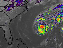 Good thing we're not a superstitious lot... when the Base Weather Station
handed us a satellite picture of Tropical Storm Michael that looked like a skull.
And it isn't even Halloween!
Good thing we're not a superstitious lot... when the Base Weather Station
handed us a satellite picture of Tropical Storm Michael that looked like a skull.
And it isn't even Halloween!
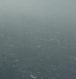
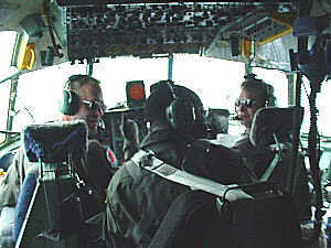
The very first flight into this system was on Tuesday morning, October 17th. No one had yet flown into it, and the storm appeared to be strengthening, but sometimes these things don't behave like "classic" hurricanes when they form so far north (near 30 degrees, in this case). While some satellite estimates were as low as 30 knots of wind, some of the experienced Hurricane Specialists believed it was nearing hurricane strength, and awaited our measurements eagerly... who would be right?