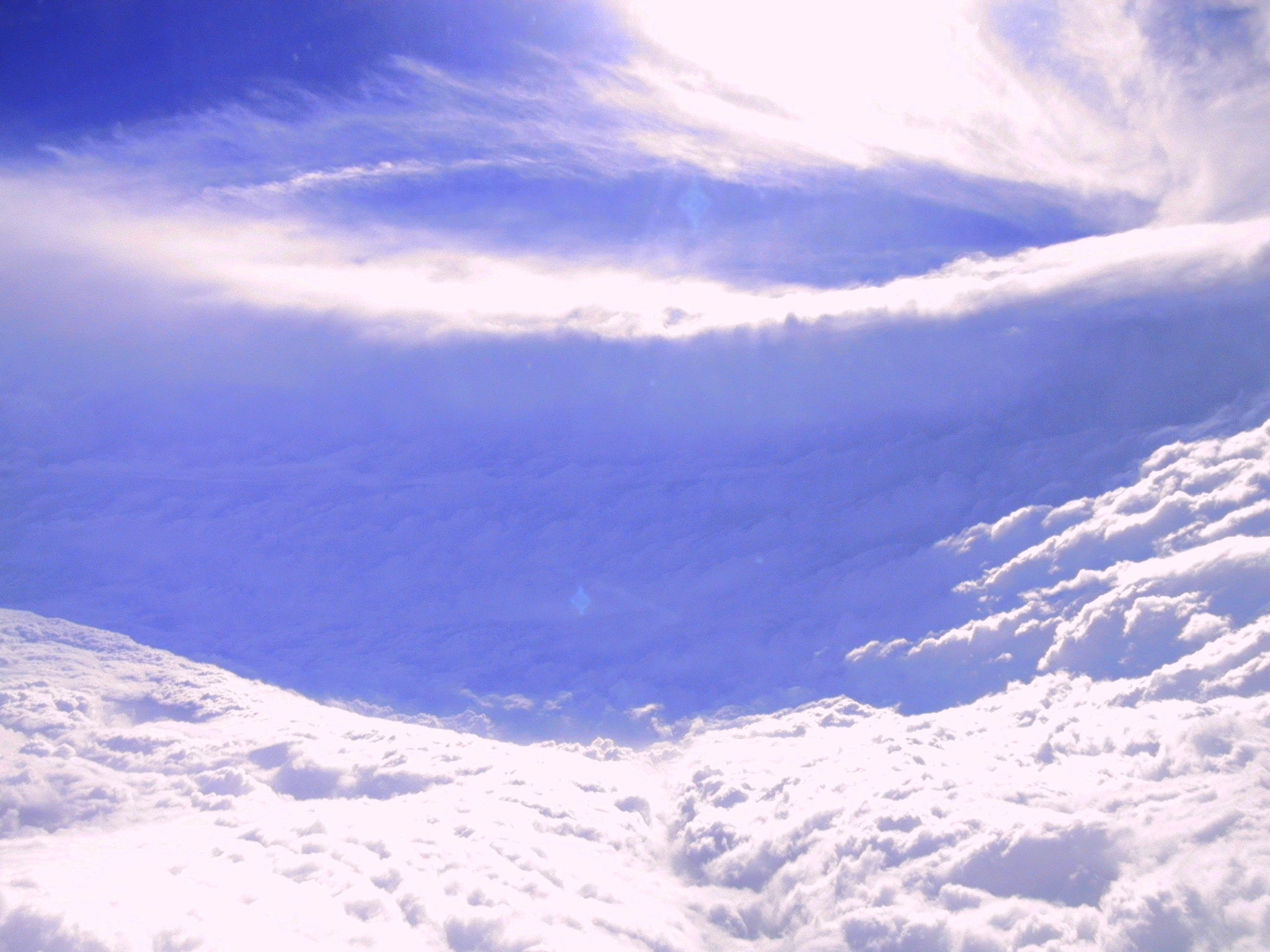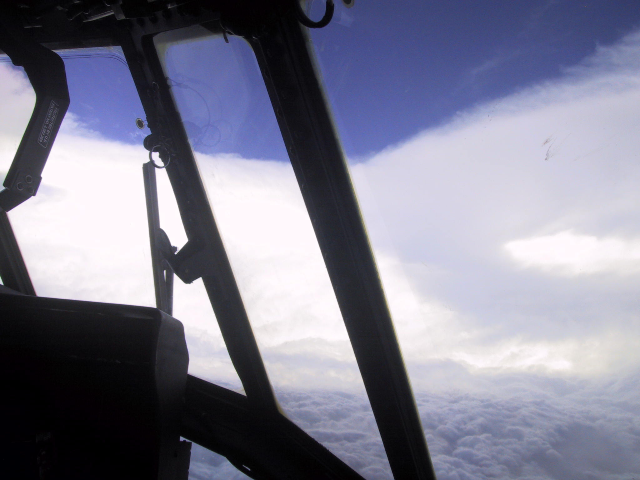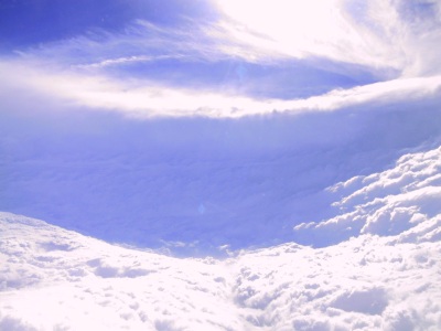
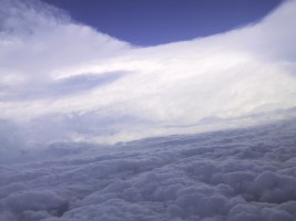
| We are always awed when we find a hurricane has intensified and displaying
the "stadium effect", which is where the wall cloud arches completely around the
eye, looking very much like a football stadium made of clouds. We find ourselves
inside this cylinder of clouds, with the top rim perhaps three or four miles above us (yes,
we fly right through those thunderstorm clouds... we can't quite get high enough to go over the top).
|
| At the point Sunday morning, when one of our dropsonde instruments showed
a sea-level pressure of 907 millibars, we realized we had a hurricane comparable to
1969's Hurricane Camille in intensity... only much larger.
|

| A NOAA aircraft behind ours measured an even lower
pressure of 902 millibars; for the moment, this was the fourth lowest pressure ever measured in the Atlantic basin (the
lower the pressure, the more intense the storm).
The next day, our crews recorded a rise in pressure on
each pass through the eye as Katrina neared our shores; we cheered each millibar of weakening, but it was with heavy hearts,
because we knew it was still going to be very terrible.
|
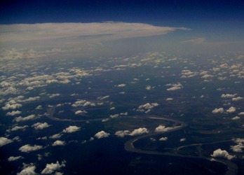
| The day before Katrina struck, our crews were flying over the "birdfoot", where the Mississippi
River extends into the Gulf of Mexico. With the towering anvil clouds of Katrina's outflow
menacing in the background, this region looked so vulnerable. This is always an eerie feeling for
us, when we fly the outer edges of our patterns and see a region in the path of a powerful storm,
and we wonder how much will change in the hours to come.
|
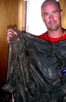
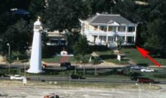
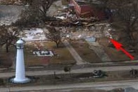
| Years of flying these storms did nothing to prepare us for the heartbreak of
the destruction to our community. Many of our crewmembers returned to homes that flooded up to the ceiling (in at least once
case, only a slab was left). We dug through the debris to see what could
be saved. Pilot Brit holds up his flight suit; the mud is so thick you can barely see the
Hurricane Hunter patch on the shoulder, under his hand. Just be glad this website doesn't
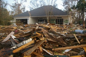
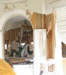
come to you in "smell-a-vision". Below are the homes of two other crewmembers.
|
| 
|
 We followed Katrina in a dozen flights, from its birth until it made landfall on our hometown.
This page
includes a few photos taken when Katrina was at its peak intensity, a powerful Category 5
hurricane. Although it weakened somewhat prior to hitting land, it was the storm surge it
that exacted the greatest toll.
Click on the photo at right for a larger version, and use your browser's
BACK key to return here .
We followed Katrina in a dozen flights, from its birth until it made landfall on our hometown.
This page
includes a few photos taken when Katrina was at its peak intensity, a powerful Category 5
hurricane. Although it weakened somewhat prior to hitting land, it was the storm surge it
that exacted the greatest toll.
Click on the photo at right for a larger version, and use your browser's
BACK key to return here .