HURRICANE HUNTERS

  • HOME
  • Cyberflight
  • Eye-to-Eye
  • Data
  • Events & PA
  • Gallery
  • Jobs
  • History
  • Background
  • FAQs
  • Ask Us
  • Links
  • Huntin' the Winter Storms

    morraines at sunset

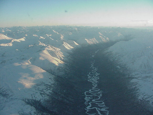
    We deployed several of our aircraft and crews to Alaska in January-February 2001 in support of the National Center for Environmental Prediction. On this day, we flew over the spectacular terrain from Anchorage to Fairbanks. The days are quite short, with sunrise around 10 a.m., and setting just six and a half hours later. The low sun angle casts long shadows across the glacier-scoured morraines. Click on the photo at right to see a larger version, and use your browser's BACK key to return here.

    Denali, left Altocumulus standing lenticular clouds hover over the peaks. These clouds form when wind flows over a mountain range; as the air is forced upward over the peak ("orographic lifting"), clouds form at the crest of the wave of air. When the winds are particularly strong, they may form several of these lens clouds in the waves of air rolling downstream. When pilots see these types of clouds, they know to beware of turbulence downwind of the mountain range.
    The highest peak in North America, Denali (above, left) stands at 20,320 feet. Denali is the Native Alaskan name for the peak also known as Mt McKinley.
    river sunset
    A long river meanders through the valley. Sunset comes earlier as we near the arctic circle, where darkness reigns around the clock.
    pilot drop
    Pilot Dave double-checks the flight plan to Fairbanks. Dropsonde Operator Robert follows along on the navigator's chart.
    Go to Winter Storm Page -or- Home